Rain event moves closer
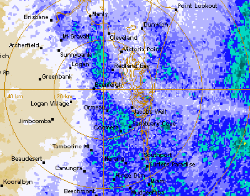
The outer ring of the rain event is on our door step, but the weather bureau says it could be a slow moving system that could hit during the overnight period.
There’ve been significant falls across the Logan-Albert region with updated figures rolling in:
In the 24 hour period to 9am Sunday, nearly 200mm of rain fell at Darlington while O’Reillys saw 276mm.
A severe weather warning remains current for heavy rainfall and damaging winds, while forecasters have updated the flood watch for the region
River level rises and minor flooding is possible across parts of the Flood Watch area from late Sunday and into Monday.
A trough is expected to deepen off the southeast Queensland coast during Sunday producing showers, thunderstorms and rain areas over the Flood Watch area. The heaviest falls are expected later in the day Sunday and will continue into Monday, particularly along the coast.
A Severe Weather Warning for heavy rainfall from Sunday is current for the Flood Watch area.
River level rises above the minor flood level are likely from Sunday. Localised flooding and disruption to transport routes is also possible throughout the Flood Watch area.
Read our earlier story: HERE.