UPDATE: Road conditions in Logan and the Scenic Rim
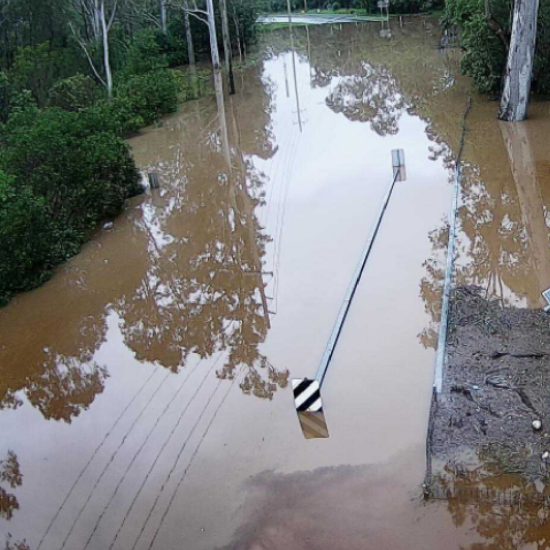
The torrential rain across Logan and the Scenic Rim is continuing to impact roads and rivers in both regions.
As a result of the rain the Scenic Rim Regional Council has alerted residents to the dangerous conditions.
It says flash flooding has affected multiple roads and 59 of them are closed or partially closed to traffic.
| Suburb | Street | Incident | Impact Type | Advice | |
|---|---|---|---|---|---|
| Council Impacted Roads | |||||
| Canungra | Double Crossing Rd | Flooding | Lanes affected – All lanes affected | Do not drive in flood waters | |
| Sarabah | Sarabah Rd | Flooding | Lanes affected – All lanes affected | Do not drive in flood waters | |
| Ferny Glen,Beechmont | Flying Fox Rd, Flying Fox Rd | Flooding | Lanes affected – All lanes affected | Do not drive in flood waters | |
| Ferny Glen | Welsh Rd | Flooding | Lanes affected – All lanes affected | Do not drive in flood waters | |
| Canungra | Curtis Rd | Hazard | Road restricted – Restricted to four wheel drive vehicles only | Proceed with caution | |
| Biddaddaba | Biddaddaba Creek Rd | Flooding | Lanes affected – All lanes affected | Observe signage | |
| Canungra | Coburg Rd | Flooding | Closures – Road closed to all traffic | Do not drive in flood waters | |
| Witheren | Darlington Range Rd | Hazard | Lanes affected – All lanes affected | Proceed with caution | |
| Tamborine Mountain | The Shelf Rd | Hazard | Lanes affected – All lanes affected | Proceed with caution | |
| Undullah | Wild Pig Creek Rd | Hazard | Lanes affected – All lanes affected | Use alternative route | |
| Biddaddaba | Armstrong Rd | Flooding | Lanes affected – All lanes affected | Do not drive in flood waters | |
| Coulson | Beaudesert Boonah Rd | Flooding | Closures – Road closed to all traffic | Do not drive in flood waters | |
| Ferny Glen | Upper Coomera Rd | Flooding | Lanes affected – All lanes affected | Do not drive in flood waters | |
| Carneys Creek | Carneys Creek Rd | Hazard | Lanes affected – All lanes affected | Proceed with caution | |
| Carneys Creek | Head Rd | Flooding | Closures – Road closed to all traffic | Use alternative route | |
| Tabooba | Tamrookum Church Rd | Flooding | Lanes affected – All lanes affected | Do not drive in flood waters | |
| Josephville | Round Mountain Rd | Flooding | Lanes affected – All lanes affected | Do not drive in flood waters | |
| Kagaru | Undullah Rd | Flooding | Lanes affected – All lanes affected | Do not drive in flood waters | |
| Kagaru | Kilmoylar Rd | Flooding | Lanes affected – All lanes affected | Do not drive in flood waters | |
| Mutdapilly,Peak Crossing | Mutdapilly Churchbank Weir Rd, Peak Crossing Churchbank Weir Rd | Flooding | Closures – Road closed to all traffic | Do not drive in flood waters | |
| Mount Alford | Ganthorpe Rd | Flooding | Lanes affected – All lanes affected | Do not drive in flood waters | |
| Beaudesert | Thiedke Rd | Hazard | Lanes affected – All lanes affected | Do not drive in flood waters | |
| Mount Walker | Stokes Crossing Rd | Flooding | Lanes affected – All lanes affected | Do not drive in flood waters | |
| Aratula | Toohill Rd | Flooding | Lanes affected – All lanes affected | Do not drive in flood waters | |
| Mount Alford | F M Bells Rd | Hazard | Lanes affected – All lanes affected | Observe signage | |
| Warrill View – Scenic Rim Regional | Ipswich Street | Flooding | Closures – Road closed to all traffic | Do not drive in flood waters | |
| Beechmont – Scenic Rim Regional | Beechmont Road | Hazard | Lanes blocked – All lanes blocked | Do not drive in flood waters | |
| Mount Barney – Scenic Rim Regional | Mt Lindesay Highway | Hazard | Lanes affected – Lane or lanes reduced | Proceed with caution | |
| Mutdapilly – Scenic Rim Regional | Cunningham Highway | Hazard | Lanes affected – Lane or lanes reduced | Proceed with caution | |
| Mount Lindesay – Scenic Rim Regional | Mt Lindesay Highway | Hazard | Lanes blocked – One lane blocked | Traffic control on scene | |
| Canungra / Sarabah – Scenic Rim Regional | Lamington National Park Road | Hazard | N/A | Observe signage | |
| Cougal – Scenic Rim Regional | Running Creek Road | Hazard | Closures – Road closed to all traffic | Use alternative route | |
| Rathdowney – Scenic Rim Regional | Boonah Rathdowney Road | Hazard | Closures – Road closed to all traffic | Do not drive in flood waters | |
| Washpool – Scenic Rim Regional | Ipswich Boonah Road ( Boonah Road) | Flooding | Lanes affected – All lanes affected | Proceed with caution | |
| Coulson – Scenic Rim Regional | Beaudesert Boonah Road | Flooding | Closures – Road closed to all traffic | Do not drive in flood waters | |
| Tarome / Tregony – Scenic Rim Regional / Southern Downs Regional | Cunningham Highway | Flooding | Closures – Road closed to all traffic | Diversions are in place | |
| Tabragalba – Scenic Rim Regional | Beaudesert Nerang Road | Flooding | Lanes affected – All lanes affected | Do not drive in flood waters | |
| Kalbar – Scenic Rim Regional | Kalbar Connection Road | Flooding | Closures – Road closed to all traffic | Do not drive in flood waters | |
| Beaudesert – Scenic Rim Regional | Telemon Street | Flooding | Closures – Road closed to all traffic | Do not drive in flood waters | |
| Coulson – Scenic Rim Regional | Ipswich Boonah Road | Flooding | Closures – Road closed to all traffic | Do not drive in flood waters | |
| Jimboomba – Logan City / Scenic Rim Regional | Bushman Drive | Flooding | Closures – Road closed to all traffic | Do not drive in flood waters | |
| Tabragalba – Scenic Rim Regional | Beaudesert Nerang Road | Flooding | Closures – Road closed to all traffic | Do not drive in flood waters | |
| Dugandan – Scenic Rim Regional | Mount Alford Road | Flooding | Closures – Road closed to all traffic | Do not drive in flood waters | |
| Kalbar – Scenic Rim Regional | Cunningham Highway | Flooding | Lanes affected – All lanes affected | Do not drive in flood waters | |
| Mundoolun – Scenic Rim Regional | Beaudesert Beenleigh Road | Roadworks | Lanes affected – Lane or lanes reduced | Changed traffic conditions | |
| Tamborine Mountain – Scenic Rim Regional | Geissmann Drive / Main Western Road | Roadworks | Lanes affected – All lanes affected | Allow extra travel time | |
| Peak Crossing – Ipswich City / Scenic Rim Regional | Allens Road / Mount Flinders Road / Ipswich Boonah Road | Special event | Lanes affected – Lane or lanes reduced | Changed traffic conditions | |
| Tamborine / Tamborine Mountain – Scenic Rim Regional | Tamborine Mountain Road | Roadworks | Lanes affected – Lane or lanes reduced | Changed traffic conditions | |
| Tamborine – Scenic Rim Regional | Beaudesert Beenleigh Road / Mundoolun Connection Road | Roadworks | N/A | Reduced speed limit (40km/h) | |
| Tamborine Mountain – Scenic Rim Regional | Tamborine Mountain Road | Hazard | Lanes blocked – All lanes blocked | Use alternative route | |
| Cainbable – Scenic Rim Regional | Lamington National Park Road | Hazard | Lanes blocked – One lane blocked | Observe signage | |
| Cainbable – Scenic Rim Regional | Lamington National Park Road | Hazard | Lanes affected – Lane or lanes reduced | Changed traffic conditions | |
| Cainbable / Kerry – Scenic Rim Regional | Duck Creek Road | Hazard | Closures – Road closed to all traffic | Use alternative route | |
| Bromelton – Scenic Rim Regional | Beaudesert Boonah Road | Roadworks | Lanes affected – All lanes affected | Changed traffic conditions | |
| Beaudesert / Josephville – Scenic Rim Regional | Mount Lindesay Highway | Roadworks | Lanes blocked – Lane or lanes blocked | Allow extra travel time | |
| Cainbable / O’Reilly – Scenic Rim Regional | Lamington National Park Road | Roadworks | N/A | Allow extra travel time | |
| Rathdowney – Scenic Rim Regional | Boonah Rathdowney Road (Burnett Creek Bridge) | Roadworks | Lanes affected – Lane or lanes reduced | Traffic control on scene | |
| Mount Barney / Palen Creek – Scenic Rim Regional | Mount Lindesay Highway (Hardgrave Road) | Roadworks | Lanes affected – Lane or lanes reduced | Allow extra travel time | |
| Coochin – Scenic Rim Regional | Maroon Dam Road | Hazard | Lanes affected – All lanes affected | Observe signage | |
In Logan 56 roads now have water washing over them.